
Key Takeaways
- Fire detection no longer hinges on chance or delayed reaction. Artificial intelligence and satellite technology are rapidly transforming how we foresee and prevent environmental catastrophes. Discover below the pivotal ways in which AI-powered fire detection and real-time satellite monitoring are reshaping our capacity to defend lives, ecosystems, and crucial infrastructure worldwide.
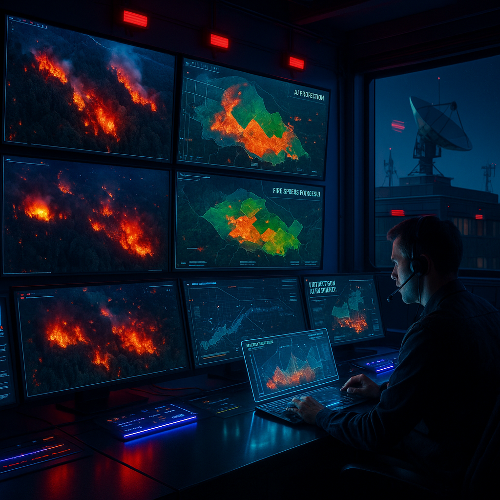
- AI-driven early warnings are redefining the concept of preparedness. Instead of waiting for visible smoke, fire detection AI rapidly processes massive streams of satellite imagery, meteorological data, and sensor networks to identify ignition points faster than traditional methods. This translates to faster alerts, more lives saved, and swifter safeguards for property and wilderness.
- Real-time satellite surveillance brings global vigilance within reach. Continuous, high-resolution monitoring enables satellites to detect fire hotspots even in remote, inaccessible, or rugged terrain, flagging anomalies before they spiral into uncontrollable wildfires.
- Dynamic risk assessment has evolved from reactive response to anticipatory action. Thanks to the seamless integration of AI with satellite data, authorities can now forecast fire spread, foresee hazardous zones, and strategically deploy emergency resources before disaster strikes. Guesswork is replaced with proactive, data-driven decisions.
- Cross-border collaboration builds resilience beyond political boundaries. AI-powered platforms encourage countries and agencies to share intelligence, knowledge, and resources, coordinating unified responses to wildfires that ignore human geography.
- AI and satellites usher in real-time, living environmental intelligence. Static risk maps are giving way to dynamic updates, sensitive to shifting climate patterns, evolving landscapes, and changing vulnerabilities. This enables adaptive, situation-aware risk management.
- Leaders overcome decision fatigue thanks to relentless data-driven filters. In the background, AI tirelessly sifts through vast stores of information, ensuring that both emergency managers and community leaders can focus on strategic actions instead of drowning in data overload.
- Ethical vigilance must keep pace with technological advancement. Society faces a vital dialogue about drawing boundaries between the benefits of life-saving surveillance and the protection of civil liberties and personal privacy. As our ability to prevent disaster grows, so does our responsibility to ensure these new tools serve the public good.
The era of passive disaster response is swiftly receding. Intelligent systems now inject foresight, analytical precision, and global perspective into the campaign against wildfires. What follows is an exploration into the crucial technologies, the far-reaching societal impacts, and the ongoing challenges at the core of AI-enhanced fire prevention. This reveals both the promise and complexity of this digital transformation.
Introduction
Wildfires rarely deliver warnings before unleashing chaos. Yet, in this age of technological progress, fire detection AI and satellite monitoring are changing the very script, spotting the faintest flicker and creating danger maps before flames have a chance to wreak havoc.
By harnessing torrents of satellite data combined with the discerning eye of intelligent algorithms, these systems deliver lightning-fast alerts, broad surveillance, and predictive insight. Emergency teams and decision-makers no longer respond solely to the sound of alarms; instead, they gain precious minutes (or even hours) to plan and act, defending lives, landscapes, and critical infrastructure.
This new era of proactive disaster prevention not only transforms our technical capabilities but also fundamentally alters our relationship with nature’s most formidable forces. As we explore the possibilities and ethical crossroads forged by this technology, we probe what it means to balance vigilance with values in a world that must anticipate, not just react to, environmental threat.
Stay Sharp. Stay Ahead.
Join our Telegram Channel for exclusive content, real insights,
engage with us and other members and get access to
insider updates, early news and top insights.
 Join the Channel
The Evolution of Fire Detection and Disaster Prevention
From Watchful Eyes to Intelligent Systems
For centuries, detecting wildfires was primarily a matter of observation and chance. Fire lookout towers, perched atop ridges and mountain peaks, formed the backbone of early detection in many regions. Staffed by individuals scanning the horizon for signs of rising smoke, these towers marked humanity’s first organized defense against runaway blazes. Throughout much of the twentieth century, ground patrols and seasoned rangers traversed wilderness areas, vigilant for the earliest evidence of fire.
Yet, these methods were hampered by clear limitations. Human vision, restricted by terrain, weather, and sheer exhaustion, could only reach so far. Vast, isolated territories often remained unmonitored. Fog, nightfall, and heavy vegetation masked deadly threats until they ballooned out of control. Overall, the approach was fundamentally reactive; fires were generally detected after ignition, not before.
The Data-Driven Revolution
The leap from reactive firefighting to data-driven prevention represents a profound shift in disaster management. This transformation was accelerated by the advent of advanced data analytics and computational modeling. Modern fire management now integrates vast and varied datasets, including:
- Historical wildfire behavior and ignition patterns
- Dynamic vegetation mapping and dryness indexes
- High-resolution topographical models
- Weather forecasting (covering wind patterns, temperature, and humidity)
- Human activity distribution and the location of critical infrastructure
California, a region repeatedly threatened by catastrophic wildfires, showcases the benefits of this shift. The ALERTWildfire network, incorporating over 900 live-stream cameras, now feeds vast amounts of visual information into analytical systems. Authorities deploy predictive models that draw from a tapestry of climatic trends and land management data. This approach is also adopted in Australia, where the response to the devastating 2019–2020 bushfires was transformed by integrating satellite imagery, weather forecasts, and AI-generated risk maps. The Australian Bushfire Data Initiative is a prime example of data-fueled, real-time risk assessment.
Globally, this transformation is felt in numerous domains. In Canada, high-tech sensor arrays and data-driven protocols support early wildfire detection across the boreal forests. Southern Europe utilizes remote sensing and risk mapping to manage Mediterranean wildfires, while African nations like Botswana combine environmental monitoring and community-led alert systems to address frequent savanna fires.
The effect is unmistakable: disaster management is no longer simply about responding to emergencies, but about preventing devastation before panic takes hold.
How Fire Detection AI Works
Technical Foundations of Intelligent Detection
The core of fire detection AI lies in pattern recognition, a digital vigilance that never sleeps. These algorithms, trained on immense libraries of wildfire images and environmental data, scan visual inputs from cameras, satellites, and drones to find the faintest signs of combustion. Each incoming image is analyzed pixel by pixel, searching for the unique blend of thermal signatures, smoke plumes, and evolving color palettes that signify a fire’s birth.
The operational sequence of modern AI-based fire detection typically includes:
- Image Acquisition: Gathering real-time visuals from ground-based cameras, UAVs, and satellites.
- Pre-processing: Enhancing and normalizing imagery for optimal analysis, accounting for lighting and atmospheric conditions.
- Feature Extraction: Pinpointing key indicators of fire, such as heat spots, changing vegetation color, or emerging smoke.
- Classification: Applying statistical models to determine with high confidence whether detected features constitute actual fire activity.
- Alert Generation: Instantly relaying actionable intelligence to relevant authorities or automated suppression systems.
Integration of Multiple Data Sources
Accuracy and resilience in AI-based fire detection hinge on synthesizing diverse sources of information. Beyond simple visual cues, these systems now process inputs from:
- IoT sensor arrays monitoring soil moisture, local temperature, and atmospheric particulates
- Weather stations reporting real-time changes in humidity, wind speed, and pressure
- Ground-based and aerial thermal imaging, especially during low-visibility or night conditions
- Historical and seasonal fire data, offering context-sensitive baselines for anomaly detection
Platforms like WIFIRE (University of California San Diego) blend satellite-derived imagery, sensor feeds, and advanced computational fire models to deliver risk forecasts and real-time mapping. In countries like Greece, AI-powered networks now couple environmental sensors with predictive analytics to pinpoint ignition threats in vulnerable olive groves and forests long before flames become visible.
Early Warning and Rapid Response
What matters most in wildfire prevention is time. Every minute gained may save thousands of acres and countless lives. AI-powered detection systems outpace traditional response protocols by automating round-the-clock surveillance. For instance, ALERTCalifornia’s implementation enabled detection of a wildfire 12 minutes earlier than the first emergency call, while Australia’s FireWatch AI platform identifies fires up to half an hour before human confirmation in remote locations.
This rapid detection has a direct, tangible impact. A 2023 CSIRO study demonstrated that areas equipped with AI-based monitoring saw a 37% reduction in average fire size during outbreaks. In places like Portugal’s Algarve region, timely automated alerts have allowed local authorities to deploy targeted resources, minimizing ecological damage and preventing urban encroachment.
The advantage is clear: early warnings, targeted intervention, smaller fires, lower costs, and, most importantly, greater safety for people and wildlife.
The Role of Satellite Monitoring in Fire Prevention
Space-Based Surveillance Technologies
The satellite era redefined humanity’s ability to observe the planet at scale. Equipped with a suite of advanced instruments, modern satellites deliver a 360-degree view of fire risks, no matter the time or location. Key space-based technologies for wildfire detection include:
- Thermal infrared sensors: Capable of registering minuscule temperature increases that betray budding ignition sites, even through light cloud cover or after dark.
- Multispectral imaging: Differentiates between types of smoke, dust, and atmospheric particulates, offering nuanced analysis of fire and non-fire events.
- Synthetic aperture radar (SAR): Delivers imagery through dense smoke or night conditions, ensuring no fire goes unseen during critical periods.
Satellites such as NASA’s MODIS (aboard the Terra and Aqua missions) can detect fires as small as a backyard pool, while the European Space Agency’s Sentinel-3 platform features targeted thermal analysis for rapid anomaly identification. Private sector advancements further enhance global surveillance, with companies deploying constellations of micro-satellites to achieve round-the-clock, region-specific monitoring.
Coverage of Remote and Inaccessible Areas
Satellites fill the void where ground-based monitoring is impossible. Dense forests, jagged mountain ranges, and sprawling savannas often remain unpatrolled by human observers. In the vast boreal expanses of Siberia, satellite surveillance brings early warning to places previously out of reach. Similarly, Brazil’s National Institute for Space Research (INPE) uses a constellation of satellites to surveil the Amazon basin, routing rapid alerts to authorities hundreds (or thousands) of kilometers from the nearest settlement.
Stay Sharp. Stay Ahead.
Join our Telegram Channel for exclusive content, real insights,
engage with us and other members and get access to
insider updates, early news and top insights.
Join the Channel
These technologies empower nations with limited ground infrastructure to leapfrog traditional limitations. Mongolia, for example, employs satellite data to track fire outbreaks across its wide grasslands, coordinating with regional firefighting teams for swift intervention. The Canadian Arctic uses orbital sensors for rapid detections, safeguarding indigenous communities and critical habitats.
Global Deployment and Coordination
Fire does not respect national borders; neither does satellite surveillance. Interagency and international cooperation are critical for optimal use:
- NASA and NOAA operate the GOES series, ensuring continuous coverage across the Americas.
- The European Meteosat network extends a digital watch over Europe, Africa, and western Asia.
- The Global Wildfire Information System (GWIS) aggregates inputs from a variety of spaceborne platforms, serving as a one-stop, real-time dashboard for fire intelligence worldwide.
- In addition, partnerships with private remote sensing firms expand access to commercial satellite imagery, weaving public and private efforts into a tightly coordinated monitoring network.
This harmonized approach enables data sharing, cross-border fire tracking, and joint emergency response. Such coordination is vital for combating mega-fires in regions where the environment and threats are shared across nations, such as Central Africa, Southeast Asia, and the Mediterranean.
Dynamic Mapping and Real-Time Updates
Where static risk maps once prevailed, today’s satellite surveillance delivers dynamic, constantly refreshed situational awareness. Modern platforms feed data directly into emergency management systems, providing:
- Up-to-the-minute maps of fire growth, movement, and spot fires
- Forecasts of likely spread direction based on wind and terrain analyses
- Tiered risk assessment layers prioritizing zones for intervention and evacuation
These capabilities proved invaluable during recent crises. During Australia’s catastrophic 2019–2020 bushfire season, satellite data guided evacuation planning and firefighting logistics as fast-moving blazes shifted course. Similarly, the United States leveraged real-time satellite and aerial data during the California Dixie Fire, coordinating deployments in hazardous terrain and protecting critical infrastructure (bridges, power lines, and even urban neighborhoods).
Beyond emergency management, these real-time maps feed into broader environmental intelligence, informing insurance assessments, forestry planning, and post-fire ecological rehabilitation on a global scale.
Synergy: Combining AI and Satellite Data
Predictive Modeling Through Machine Learning
The potent synergy between AI and satellite monitoring is rooted in prediction rather than just detection. Machine learning algorithms digest torrents of satellite-collected data (vegetation health, atmospheric conditions, topographical nuances) and evolve to anticipate where and when fires are most likely to ignite.
Predictive modeling leverages:
- Correlations between drought indices and ignition risk
- Terrain features that accelerate or slow fire spread
- Historical interactions between human activity, infrastructure, and fire outbreaks
- Continuous learning from each new fire season, which tunes both accuracy and relevance
A practical example can be seen in Europe, where the Copernicus Emergency Management Service employs AI to assimilate land use maps, population density, and weather forecasts. This generates dynamic risk heatmaps shared with local authorities for daily resource allocation.
The benefits ripple across industries. In insurance, predictive fire modeling informs premium setting and helps underwriters identify properties at high risk. For urban planning, insights into wildfire risk support strategic zoning and resilient infrastructure development. In healthcare, models predict potential impacts on air quality and vulnerable populations, empowering proactive patient care during smoke events.
Enabling Proactive Resource Allocation
The integration of AI and satellite data does more than sound alarms; it orchestrates the movement of resources with a degree of precision previously unimaginable. Emergency managers can simulate multiple fire growth scenarios, identify critical choke points for containment, and stage equipment in optimal locations.
For example, in South Africa’s fynbos biome, integrated data-driven models are used to preposition firefighting aircraft and coordinate cross-jurisdictional responses, reducing both response times and overall fire suppression costs. Similarly, forest managers in Canada rely on AI-analyzed satellite feeds to schedule preventive burns and prioritize hazardous fuel removal in zones of greatest vulnerability.
Strengthening Resilience Across Sectors
This predictive, holistic approach brings transformative benefits well beyond disaster response. Utilities companies use risk forecasts to trigger targeted power outages or infrastructure inspections in high-threat corridors, reducing the likelihood of electrical fires igniting new disasters. Transportation agencies adjust routes and maintenance schedules based on evolving risk maps, safeguarding commuters and critical supply lines.
Even agricultural planners benefit. By anticipating fire seasons, they can protect crops, livestock, and agricultural infrastructure through informed rotation strategies and insurance planning.
The integration of these technologies creates a future in which society is not merely defending against wildfires, but actively managing landscape-level risk in real time.
Challenges and Ethical Considerations
Balancing Technological Progress with Civil Liberties
With the proliferation of surveillance tools, both terrestrial and orbital, the question of privacy and ethical boundaries becomes inescapable. The very attributes that make these systems powerful (persistent observation, data integration, global coverage) also give rise to concerns about misuse, data security, and the erosion of individual autonomy.
How do we ensure early warnings do not morph into round-the-clock monitoring of private spaces? Who owns the data collected by public satellites or private drones, and what safeguards guarantee it is used solely for the collective good? These are not speculative worries. Debates over data privacy, transparency, and consent have already prompted legal and regulatory scrutiny in the United States, European Union, and Australia.
Fostering Transparency and Trust
Public acceptance of wide-scale surveillance technology demands robust oversight, clear communication, and meaningful consent. Agencies employing AI-powered disaster prevention systems must:
- Establish transparent policies regarding data collection, retention, and use
- Involve communities in technology deployment decisions, especially in regions with histories of surveillance-related abuses
- Regularly audit algorithms for bias, unintended consequences, or mission creep
- Encourage independent review by ethicists, privacy advocates, and local stakeholders
Equity, Accessibility, and Global Justice
The benefits of AI and satellite monitoring must not be restricted to wealthy or technologically advanced regions. Global justice requires affordable access to vital satellite data and open-source AI tools for nations battling fires with limited financial or technical means. International aid organizations and non-profits have crucial roles in democratizing the deployment of these life-saving tools and ensuring capacity-building worldwide.
Conclusion
Artificial intelligence and space-based monitoring have fundamentally redefined how humanity faces wildfires. We have moved beyond the passive limitations of watchtowers and manual reports, entering an era structured around anticipation, precision, and interconnected global vigilance. By weaving together real-time sensor networks, sophisticated computer vision, and continuously updated satellite imagery, modern detection systems trade in minutes and hours that may stand between preventable tragedy and manageable incident.
This transformation is not merely technological. It signals a paradigm shift in how societies interpret risk, safeguard natural and built environments, and wield human ingenuity in partnership with “alien” intelligence. It opens pathways for smarter collaboration among nations, cross-industry resilience strategies, and more holistic stewardship of vulnerable ecosystems.
Yet, in harnessing these tools, we are also entrusted with new responsibilities. As advances in surveillance and AI reshape the landscape of prevention, society must remain vigilant about the balance between safety and privacy, data sharing and individual rights.
Looking forward, those who will shape the next chapter in disaster resilience are the leaders and communities who adapt quickly, foster transparent dialogue, and leverage the full promise of digital innovation while never losing sight of the human values that must guide its application. The future belongs not just to those who use technology, but to those who wield it wisely: anticipating threats, respecting boundaries, and continually asking, “How do we cultivate resilience, compassion, and foresight in a world lit by intelligence from both above, and within?”
AI for Wildlife Corridor Mapping
biodiversity conservation
AI coral reef conservation
ethical data collection
AI personal knowledge management


Leave a Reply