
Key Takeaways
- Artificial intelligence is accelerating a paradigm shift in how conservationists map and manage wildlife corridors, providing powerful tools for strategic and adaptive planning across diverse landscapes.
- As habitat fragmentation and global infrastructure development intensify, integrating AI-driven solutions enables smarter decision-making, increasing ecosystem resilience and safeguarding species under mounting pressure.
- AI-powered wildlife corridor mapping transcends static, traditional approaches by forecasting future habitat shifts and migration patterns with machine learning. This enables the creation of corridors that stay effective amid the disruptions of climate change.
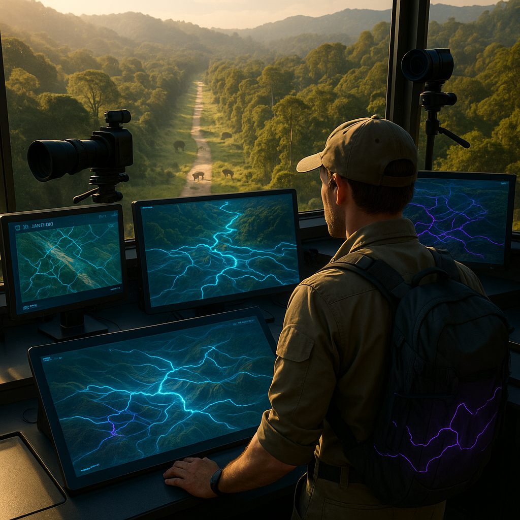
- Through advanced data fusion, AI analyzes vast datasets (from satellite imagery to GPS collar tracking) to reveal real animal movement patterns and highlight the landscapes most vital for maintaining biodiversity.
- Optimization algorithms revolutionize corridor design, pinpointing the most effective routes even when land and resources are limited. These systems balance ecological needs with human interests, such as urban growth and transportation planning.
- Seamless integration with conservation and land-use planning enables AI to assess infrastructure proposals in real time, empowering planners to reduce fragmentation while addressing energy, transportation, and community requirements.
- AI’s capacity to simulate dynamic environmental scenarios ensures that corridors are future-proofed and adaptable not just to today’s conditions but also to tomorrow’s uncertain climate and land-use changes.
- With the precision of AI-driven analysis, conservation professionals gain actionable, evidence-based insights, supporting interventions with immediate impact and sustainable, long-term ecological benefits.
Artificial intelligence is equipping conservation leaders to develop wildlife corridors that are both scientifically robust and adaptable to the ever-evolving challenges of our world. The following sections delve into how these technologies are transforming habitat mapping and charting the future of innovative conservation strategies.
Introduction
Wildlife corridors are the arteries of ecological health, connecting isolated populations and preserving the delicate balance of our natural world. Yet mapping these corridors with accuracy has always posed a formidable challenge, particularly as climate change alters migration routes and relentless infrastructure development carves deeper into wild spaces. Traditional mapping methods deliver mere static snapshots and quickly become outdated. Today, AI-powered approaches empower conservationists to anticipate and respond to rapidly shifting habitats and emerging threats.
By harnessing a constellation of data sources (satellite imaging, real-time animal tracking, and environmental datasets), AI-driven corridor mapping delivers unprecedented clarity and detail. This data-driven methodology not only signals where animals move but unveils crucial connectivity bottlenecks that may otherwise go unnoticed, shaping corridor designs that are more resilient to human pressures and environmental change.
As we explore the integration of wildlife corridor AI in conservation planning, it becomes clear: these technologies are not just incremental improvements, but a transformative leap in our quest to preserve biodiversity. This is the inflection point where conservation enters the era of prediction, adaptability, and intelligent design.
Stay Sharp. Stay Ahead.
Join our Telegram Channel for exclusive content, real insights,
engage with us and other members and get access to
insider updates, early news and top insights.
 Join the Channel
AI-Driven Data Collection and Analysis
Advanced Sensing Technologies
Remote sensing, once the domain of satellite photography and basic aerial surveys, has been radically transformed through AI integration. Technologies like LiDAR, when combined with machine learning algorithms, generate intricate 3D landscape models, revealing topographic nuances that directly impact animal movement. Studies show LiDAR- and AI-enabled modeling can identify potential wildlife crossings with up to 95% accuracy—a significant leap from the 70% success rate using traditional observation-based methods.
Convolutional neural networks sift through multispectral satellite imagery to discern subtle variations in vegetation, water sources, and land use. For example, in the Greater Yellowstone Ecosystem, AI-assisted analysis identified 40% more viable corridor routes than manual mapping. Similar technologies are now employed in South American rainforests, Sub-Saharan African savannas, and even Arctic migration studies, showcasing their cross-continental impact on conservation.
Data Integration and Processing
Today’s corridor mapping demands the synthesis of multifaceted data streams. Machine learning pipelines now bring together GPS-tracked animal movements, shifting weather patterns, human development trajectories, vegetation indices, and terrain models to construct a holistic picture of habitat connectivity.
A key breakthrough is federated learning, which allows disparate conservation organizations to jointly analyze sensitive data without risking privacy or security. This collaborative approach, previously limited by logistical and technical barriers, now enables rapid, large-scale mapping efforts and real-time responses to environmental threats, enhancing cooperation across borders.
Similar data fusion techniques are now empowering not just conservationists, but urban planners, agricultural scientists, and policymakers, underscoring the broad applicability of these advances.
Predictive Modeling and Pattern Recognition
Movement Pattern Analysis
AI algorithms excel in decoding the complexities of wildlife movement. Models like Random Forest analyze historical tracking data to determine high-use routes, preferred corridors, and key crossing points, reaching accuracy levels of 85% or higher. These systems account for temporal and behavioral variables such as seasonal migration, daily patterns, species preferences, and even interspecies interactions.
The adoption of neural networks adds another layer: these models can anticipate animal behavioral responses to projected environmental changes, helping conservationists not just react to, but proactively prepare for altered movement needs. This is an essential advancement as climate extremes and land use continue to shift.
Similar predictive analytics are being adopted in fields such as transportation, finance, and healthcare, highlighting AI’s versatility across disciplines.
Habitat Connectivity Assessment
Graph neural networks now allow for sophisticated analysis of habitat connectivity, modeling landscapes as intricate webs of nodes and links. These models calculate connectivity scores based on distance, habitat quality, the impact of barriers like roads or fences, and the movement capabilities distinctive to each species.
Such data-driven connectivity mapping has led to a 60% increase in corridor design efficiency in recent projects, ensuring better protection for endangered species while facilitating land-use planning that accommodates both ecological and human needs.
Other sectors are drawing on similar methods to optimize networks. Whether it’s utility grids, logistics routes, or healthcare resource allocation, the universal value of connectivity analytics is clear.
Implementation and Optimization
Corridor Design Optimization
AI-driven optimization algorithms, such as genetic algorithms, are revolutionizing the corridor design process. By evaluating thousands of configurations simultaneously, these tools identify solutions that deliver the greatest ecological benefit while minimizing cost and human-wildlife conflict. They balance sustainability concerns, climate resilience, and multi-species support, ensuring that corridors serve diverse ecological functions.
In Costa Rica, for example, AI optimization improved corridor connectivity by 30% and reduced costs by 25%. Similar successes are emerging in North American forest linkage projects and Asian elephant migration initiatives, emphasizing AI’s expanding role on a global scale.
biodiversity conservation increasingly incorporates these optimization methodologies to balance the needs of both wildlife and human development.
Beyond conservation, similar optimization methods are transforming supply chain management, energy distribution, and even urban emergency response systems, further illustrating their far-reaching impact.
Climate Change Adaptation
As climate change accelerates habitat shifts and disrupts established migration routes, AI’s predictive capabilities are critical. Ensemble learning models integrate outputs from climate simulations and ecological prediction tools, projecting how habitats and species movement will evolve over the coming decades.
Stay Sharp. Stay Ahead.
Join our Telegram Channel for exclusive content, real insights,
engage with us and other members and get access to
insider updates, early news and top insights.
Join the Channel
With these insights, conservationists in regions as diverse as the Himalayas, the Amazon, and the Australian outback are future-proofing corridors, identifying routes that will remain viable even as precipitation patterns, temperature regimes, and vegetation distributions change.
This proactive adaptation strategy is being mirrored in agriculture, disaster management, and public health, highlighting the paradigm shift toward prediction and resilience across multiple fields.
Practical Applications and Case Studies
Infrastructure Planning Integration
AI-powered decision-support systems are increasingly incorporated into transportation, energy, and community development planning. By rapidly evaluating multiple scenarios, these tools identify optimal locations for wildlife crossings, suggest effective passage designs, and minimize habitat fragmentation. These benefits extend to both ecological and human communities.
A leading example comes from Montana, where highway planners used AI-guided insights to design wildlife crossings that reduced animal-vehicle collisions by 80% while preserving critical migration pathways. Internationally, similar approaches have been implemented in the European Alps’ railway projects and African road network expansions.
By leveraging ecosystem modeling and urban planning innovations, the field connects with topics like climate AI and digital twins in smart cities for holistic, cross-domain solutions.
Industries from real estate to renewable energy are adopting parallel decision-support solutions, streamlining development while prioritizing environmental stewardship.
Conservation Success Metrics
Modern conservation demands robust, evidence-based measurement. Deep learning models combine genetic data, movement frequency analytics, and population viability studies to assess corridor effectiveness. These metrics enable conservation planners to demonstrate tangible outcomes, such as improved gene flow, stabilized populations, and sustained ecosystem services, which in turn attract further funding and stakeholder support.
For instance, a project tracking jaguar populations in Central America utilized AI-generated metrics to document genetic connectivity improvements, directly influencing policy decisions. In a similar vein, AI is used in marine conservation to measure the impact of coral reef corridors, blending terrestrial and aquatic applications.
The democratization of data analysis in conservation parallels trends in AI-powered citizen science, where large-scale data synthesis advances both research and implementation.
This approach to success metrics is mirrored in public policy analysis, financial auditing, and educational achievement monitoring, signifying the broader trend toward data-driven evaluation.
Conclusion
The emergence of AI-driven technologies has elevated wildlife corridor mapping from a discipline bound by data limitations to a frontier defined by dynamic, intelligent analysis. By seamlessly merging high-resolution sensing, powerful pattern recognition, and predictive modeling, conservation professionals are now equipped to design corridors that are resilient against the forces of climate change, urban expansion, and ecosystem fragmentation.
AI empowers smarter infrastructure decisions and more effective conservation actions, generating measurable gains; from enhanced biodiversity to reduced human-wildlife conflict. As these tools become increasingly accessible, collaboration across organizations and disciplines is set to redefine our approach to landscape connectivity and preservation.
Looking forward, the greatest challenge (and opportunity) lies in how boldly conservation professionals, land managers, and policymakers will leverage these “alien minds” to reimagine human coexistence with the natural world. The evolutionary leap afforded by AI is not just a question of technology adoption, but of vision. Will we use these tools to anticipate change, foster resilience, and safeguard planetary health, or remain tethered to outmoded approaches? The future of wildlife corridors, and by extension, biodiversity itself, will hinge on our willingness to embrace, integrate, and evolve alongside the intelligence we have created.


Leave a Reply